National Parks of Zimbabwe
GPS-taugliche Nationalparkkarten mit GPS-Koordinaten, Dt/engl - The Tourist Map
€9.00
(inklusive MwSt.)
Verfügbarkeit: Beim Verlag bestellbar. Führen wir nicht bzw. nicht mehr
Zusatztext
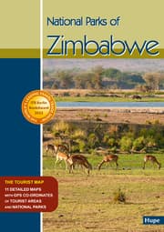
Elf aktuelle detaillierte Karten der bedeutendsten Nationalparks von Zimbabwe, zweisprachig englisch/deutsch mit zahlreichen GPS-Koordinaten: Zambezi NP, Mana Pools NP, Hwange NP, Gonarezhou NP, Matusadona NP, Chizarira NP, Nyanga NP, Matobo NP, Kazuma Pan NP, Kyle Recreational Park, Kariba Recreational Area This new Zimbabwe Map is the first and most accurate and comprehensive map for the National Parks of Zimbabwe, including GPS-co-ordinates. Covering the touristic road network of Zimbabwe with detailed, most accurate and comprehensive maps of the most important national parks in Zimbabwe.
Autorenportrait
Manfred Vachal hat sich in den letzten 28 Jahren einen hervorragenden Ruf für Afrika-Reiseliteratur und Kartographie erarbeitet. Manfred Vachal has earned an excellent reputation for African travel literature and cartography over the past 28 years.
Weitere Details
Erschienen: 17.08.2022
Sprache: Deutsch
Einband: GEF
Format: 0.3 x 21 x 15 cm
ISBN/EAN: 9783932084966
Umbreit-Nr.: 6403392
